Smart Hazard Detection
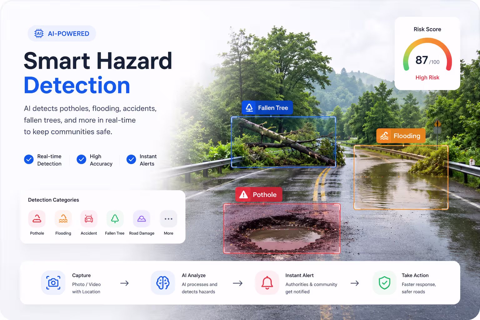
AI automatically identifies potholes, flooding, road debris, fallen trees, damaged infrastructure, and traffic hazards from images and reports in real time.
PotholesFloodingFallen TreesRoad DebrisDamaged RoadsTraffic Hazards
AI-powered civic road damage reporting for BIMSTEC nations. Snap. Submit. Track.
Three steps from pothole to fixed.
Capture the road damage with your phone. Location is tagged automatically.
Our model identifies the damage type and severity in seconds.
The report reaches the right local authority and you get email updates.
Advanced computer vision, risk analysis, and predictive insights help communities identify hazards faster, prioritize responses, and prevent accidents before they happen.
AI automatically identifies potholes, flooding, road debris, fallen trees, damaged infrastructure, and traffic hazards from images and reports in real time.
Every detected hazard receives an AI-generated risk score to help authorities prioritize critical incidents and allocate resources efficiently.
High Risk
Analyze historical reports, environmental conditions, and community activity to predict accident hotspots and emerging risk zones.
© Mapbox © OpenStreetMap
Capture
Photo • Video • Location
AI Analysis
Computer Vision Detection
Risk Scoring
Severity Classification
Authority Alert
Real-Time Notifications
Resolution
Monitor Progress
Everything you need to report, track and resolve road damage.
Detects potholes, cracks, waterlogging and debris automatically.
Follow every report from submitted to resolved.
Stay informed at every step with timely email updates.
Draft reports without a connection and sync when you're back online.
Report in your language across all BIMSTEC nations.
PostGIS-powered geolocation pinpoints damage accurately.
Serving seven member nations, with more coming online.
हिन्दी
বাংলা
नेपाली
རྫོང་ཁ
မြန်မာ
සිංහල
ไทย
Takes less than 60 seconds. No login required for basic reports.
Report a Road Issue